Woodford is a settlement located on the southern boundary of the Metropolitan Borough Council of Stockport in Greater Manchester, bordering Cheshire. Woodford is designated as Green Belt. The first impression gained by anyone passing through Woodford along the main road in a car does not reveal the true character of the place or its people. This brief overview aims to provide a deeper glimpse into the bigger picture.
Geology Articles can be found towards the bottom of this page.
*New Article - January 2021 - The History of Woodford Aerodrome
The story began in 1907 when AV Roe won an award in a Daily Mail aircraft competition and a biplane based on its design made its first flight in 1908. In 1910, AV Roe and his brother, HV Roe, set up AV Roe &Co Ltd (Avro) in Manchester, the world’s first company to be registered as an aircraft manufacturer. Just before WWI, Roy Dobson joined the company and developed a lasting friendship with the aircraft designer/engineer, Roy Chadwick. The company developed the Avro 504, which had excellent flying characteristics and over 8,000 were manufactured during the war.
After the end of WW1, Avro continued to develop aeroplanes and moved their test flying activities to Woodford, having purchased land at Newhall Farm in 1924. In 1925 Woodford Aerodrome was opened, marking a key milestone in the history of aviation at Woodford.
In the late 1930s, with the country gearing up for WWII, the company set up a large production factory at Chadderton and an assembly plant/flight test centre at Woodford. After the war, a number of changes in the business included associations with Crossley Motors and Armstrong Siddeley. The company was absorbed into Hawker Siddeley Aviation in 1960 and in 1977 Hawker Siddeley Aviation became British Aerospace. In 1999 British Aerospace merged with Marconi Electronic Systems to form BAE Systems, specialising in aerospace, arms and information security.
 |
|---|
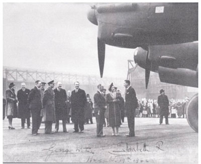
| King George V1 and Queen Elizabeth visit the Avro factory in 1942 [Photograph included with kind permission from Heather Braddock] |
Over the years a wide range of different types of aeroplanes were produced at Woodford. Here is just a flavour of some of the notable names.
The Avro Anson was a light transport aircraft. 11,000 were produced between 1935 and 1952.
The Avro Lancaster, powered by four Merlin engines, was a redesign in 1940 of the twin engine bomber, the Manchester.
The “Dam Buster” aircraft was developed by Roy Chadwick, Roy Dobson and a test pilot by the name of Sam Brown, as a refinement of the Lancaster to carry the Barnes Wallis “bouncing bomb”.
The Avro Lancastrian was a long distance passenger plane with overnight accommodation operated from 1946 by Quantas between London and Sydney.
The Avro York, based on the Lancaster, used by Churchill during WW2 and after the war a mainstay of the Berlin Airlift
The Avro Shackleton was another derivative of the Lancaster named after the explorer, Ernest Shackleton. It entered service with the RAF in 1951 for long range maritime patrol.
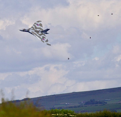
The Avro Vulcan is probably the most well-known and iconic product of aviation industry at Woodford. It was a delta wing, jet powered bomber, which represented an imaginative leap in aerodynamic design by Roy Chadwick. The first Vulcan flew from Woodford in 1952. It was a vital part of Britain’s strategic defence system for 30 years. Its final mission during the defence of the Falkland Islands in 1982 involved the longest non-stop mission ever undertaken by the RAF. A similar, radical delta wing design was also used later in Concorde.
 |
|---|
| Vulcan in flight over Woodford in 2015 by Robin Berriman |
In the 1980s, production of the BAE146 Regional Jet was transferred to Woodford. It sold well round the world, including to the Royal Flight.
The Hawker Siddeley Nimrod largely replaced the Shackleton for maritime reconnaissance. BAE Systems won the contract to modernise Nimrod, resulting in the MRA4 with increased flight range and excellent radar facilities. However, Government orders for the aircraft were cancelled, ultimately resulting in the closure of BAE Systems at Woodford in 2011 and the sad destruction of Nimrod planes already in the final stages of production.
This marked the end of an era in Woodford. In 1989, 3000 people were employed on the site. Many employees had commuted from surrounding areas and long-standing residents will recall the traffic queues at the end of shifts at the factory. They may also recall the deafening roar that filled the village when jet engines were tested. The number of employees fell, with the loss of the final 630 jobs when BAE systems closed the site in 2011. As we all know, the site was sold to Harrow Estates and Redrow Homes began building houses on the site in 2015.
Echos of Woodford’s aviation history remain. The names of some of these aircraft and the people associated with them are now street names in the new Redrow housing estate and playgrounds on the estate incorporate propeller designs. Propeller motifs also adorn the Woodford Road/Chester Road roundabout. Even more fitting is the fact that a former Vulcan pilot now lives on the Redrow estate.
BAE agreed to fund the renovation of the former aerodrome fire station to become the new Avro Heritage Museum when the Woodford Aerodrome site was sold. A visit to the museum is recommended, where you can find much more information than is included here. There are a large number of exhibits and activities, including cockpit tours, Nimrod tactical station and Vulcan flight simulator and a white Vulcan is on display outside. The museum is currently closed due to the Covid Lockdown, but will open again when restrictions are lifted. You can find details on the link at the end of this newsletter.
Many residents will also recall the Woodford Airshow, which ran every year for 33 years from 1968 to 2005. More on this in a future edition of the newsletter.
Further information is available here:
Article by Paul Rodman in Woodford Parish Magazine
BAE Systems Heritage
Sir Roy Harvey Dobson
Roy Chadwick
A book entitled “Woodford, Glimpses into the Past” by Heather Braddock
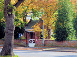
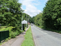
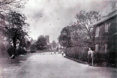
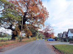
Arriving into Woodford
  |
|---|
| Wilmslow Road and Christ Church |
  |
| Hall Moss Lane |
Photos
There are several more photographs, mentioned in the history, below including arriving into the village, roads, lanes and listed buildings displayed underneath the text. Also there is a gallery with around 60 photos, taken by residents, in and around Woodford at different times of the year.
History
Deep History
There have been major fluctuations in the climate on earth in its 4.5 billion year history. The early atmosphere was largely carbon dioxide with little or no oxygen. 2.7 billion years ago single celled organisms that were able to use this carbon dioxide and the energy from sunlight in a process known as photosynthesis evolved on earth. The plants we see on earth today have evolved from these organisms and use this process. A by-product of photosynthesis is oxygen and so, with the arrival of photosynthesis on earth, carbon dioxide levels reduced and oxygen levels increased in the atmosphere. Although some simple animals have been found which can survive at very low oxygen levels, it is thought that increasing oxygen levels may have contributed to conditions which allowed the evolution of the great diversity of animal life and eventually humans, who are a very recent addition to life on earth in the massive timescales involved. During the relatively warm Carboniferous Period, 300 million years ago, before significant cooling of the climate and an Ice Age, plants grew and died at a great rate. Carbon dioxide reduced and atmospheric oxygen levels were the highest the earth has ever experienced. Layers of dead plants eventually became coal, oil or gas when compressed under subsequent layers. Coal measures dating back to the period are found to the east of Woodford in neighbouring Poynton.
Artist’s Impression of the coal forests of Europe in the Carboniferous Period (https://www.bbc.co.uk/news/science-environment-11870322) |
|---|

After the Carboniferous Period, the climate on earth cooled and an Ice Age followed. From the end of that Ice Age 11,500 years ago, England became covered in increasingly dense forests of oak, hazel and birch, with some pine. When people began farming, the tree cover slowly began to give way to pasture and cultivated land. Under Anglo-Saxon kings, the forests still belonged to the landowners and their subjects, but William I introduced "Forest Law", which claimed the open moors and woodlands as the hunting grounds of kings.
Middle Ages
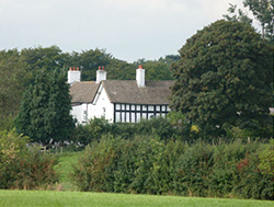
In the Middle Ages, Woodford was part of the royal hunting forest and, in 1248, the manor of Woodford was one of several in the Barony of Stockport. In 1300, the forest stretched from Leek in the south to Marple in the north and was 10 miles wide along the western Pennines. Land was cleared and improved for agriculture in the late 13th century and a corn mill existed by 1296. In the 13th century, Woodford (known as Wideford or Wydeford) was a subordinate manor in Poynton held by the Stokeports. In 1355, land at Woodford was granted to the Davenport family. At this time Woodford was a hamlet on the edge of the Macclesfield Forest.
The Davenports originally lived in Old Hall on Old Hall Lane which is now Old Hall Farm. The date is uncertain, but it was known to be there in 1370, much of the original building having been destroyed by fire. The Davenports built New Hall further down the lane in 1630. Their initials and Coat of Arms appear above the entrance. It was used by the family until it was purchased by AV Roe company in 1924.
Woodford was in the middle of a densely wooded area and, as the name implies, there was a ford where the footpath now crosses the River Dean near to Old Hall Farm, providing a route to Macclesfield.
Sources of information include:
https://www.bbc.co.uk/bitesize/guides/zg4qfcw/revision/1
https://www.nationalgeographic.com/science/prehistoric-world/carboniferous/
http://www.bbc.co.uk/earth/story/20150701-the-origin-of-the-air-we-breathe
“A Scrapbook of Woodford” compiled by members of the WI and friends 1950 – 1953, the Woodford Rose Queen Golden Jubilee Souvenir Programme 1989 and “Woodford, Glimpses into the Past” by Heather Braddock 2004.
19th and 20th Centuries
In the 19th century, in addition to agriculture, many residents in Woodford were engaged in trade and industry. There was a blacksmith, a brick maker and a calico printing mill. Silk weaving was a domestic industry carried on in a number of homes, including some of the old cottages which remain in Woodford today.
Chester Road and Christ Church in 19th Century
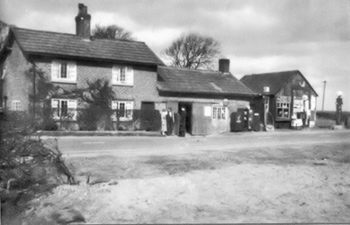
Smithy Garage on Chester Road in 1930s
In 1837, the Dean Water calico printing mill was built where Wilmslow Road crosses the River Dean. Deanwater House (now the Deanwater Hotel) became the manager's house and cottages for the workforce were built in Kingstreet, the name formerly referred to this hamlet, rather than the road. The mill closed in 1848 and burnt down in 1851. 172 people were employed at the mill, of which half lived in the parish of Woodford.
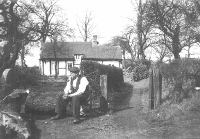
Tom Hallworth, Blacksmith, outside Smithy Cottage, c. 1930
Christ Church was built in 1841, a primary school was built in 1847 at the instigation of the Bromley-Davenport family. Farms, small holdings and cottages on the Woodford Estate were rented by tenants and many local names appear in the list of tenants, including Hallworth, Worthington, Shatwell, Jepson and Holland. In 1922, the estate was sold by the Davenports and purchased by Arthur Fifette, who put it up for auction in 52 lots. Many former tenants purchased their properties. The sale of the estate allowed new dwellings to appear in Woodford, resulting in small developments along the main streets, such as Chester Road and Moor Lane, which were originally country lanes. The structure, character and community of Woodford reflect that history and descendants of those families still live here today.
Parts of a war-time RAF Maintenance Unit lay within the north western corner of the Woodford Neighbourhood Area. These included a site lying immediately east of Dairyhouse Lane, part of a railway system and smaller sites located at various points just south of Hall Moss Lane. The majority of the unit was closed in 1959.
The Davenport Arms, known locally as the Thief’s Neck carries the Davenport Coat of Arms which includes an image of a felon with a rope around his neck. In a Scrap Book of Woodford 1953, members of the WI and friends reported that old inhabitants could recall the current Davenport Arms being built to replace an earlier one which was a thatched building destroyed by fire.
Photographs included above with kind permission from Heather Braddock who has written an excellent book on the history of Woodford entitled “Woodford, Glimpses into the Past”, where you will find much more information. Other sources of information include “A Scrapbook of Woodford” compiled by members of the WI and friends 1950 – 1953 and the Woodford Rose Queen Golden Jubilee Souvenir Programme 1989.
Woodford Aerodrome was a major landmark. The airfield was created from farmland by AV Roe during late 1924. In the mid-1930s several new buildings were erected prior to the start of the Second World War. Planes manufactured there include Avro Ansons, Lancasters, Vulcan nuclear bombers, civil airliners and the Nimrod maritime patrol aircraft. From 1968 to 2000 an annual air show was held at the Aerodrome, organised by the Royal Air Forces Association. In 1989, 3000 people were employed on the site, but in 2012 BAE Systems closed the site with the loss of the remaining 630 jobs. The site was purchased by Harrow Estates and the buildings have been demolished to make way for houses. The Avro Heritage Museum has been created on site with an excellent display, including a static Vulcan.
Woodford War Memorial Community Centre was built in 1953 on a 4 acre plot on Chester Road as a memorial to those who lost their lives during World War II. The money was raised by interest free loans from members of the community and fund raising activities. Now under the custodianship of the Charities Commission the premises and operation are covered by a constitution, with daily running organised by a committee of volunteers. The roof shape was designed with acoustics for amateur dramatics in mind and, while it is generally acknowledged that the building is not a thing of beauty, the facility is precious to the community.
District boundaries have changed over time. In 1866 Woodford, was part of the parish of Prestbury, in Macclesfield. In 1939, it was incorporated into the district of Hazel Grove & Bramhall, which included the hamlet of Moor End and in 1974 it became part of the Metropolitan Borough of Stockport.
The population of Woodford was around 300-400 in the 19th Century, with a marked increase over the last 100 years. Census data show that the population was 430 in 1851, 392 in 1861, 304 in 1901, 801 in 1931, and 1,211 in 2011. The electoral register in 2014 included 1,157 people in Woodford. The number of dwellings has increased with the population. According to census data, in 1861 there were 83 dwellings (9 unoccupied) in Woodford, compared with 610 dwellings in the Woodford Neighbourhood Area in 2015, as calculated by the WNF management committee.
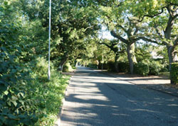
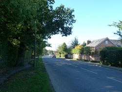
| Roads and Lanes |
|---|
  |
| Chester Road and Church Lane |
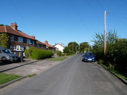  |
| Bridle Road and Moor Lane |
  |
| Behind Chester Road and Behind Wilmslow Road |
  |
| Behind King Street and In the centre of Woodford |
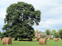
Woodford Today
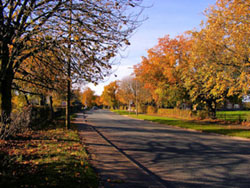
The settlement of Woodford adjoins suburbia in Bramhall and Cheadle Hulme and comprises ribbon development along the A5102 and A5149, but it still retains some of its village character and farming community, with a network of winding country lanes off the beaten track. It is predominantly agricultural land and the built environment (domestic and commercial curtilage and roads) represents a smaller proportion of the area.
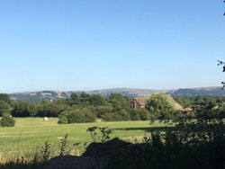
Farms, small holdings, lanes, hedgerows, trees, old cottages and listed buildings, intermingled with more recent development and roads, reflect the long history of a settlement at Woodford. The openness of the countryside and wide gaps in the housing curtilage provide views across farmland to the Pennine hills to the east. These features contribute to the landscape character of Woodford.
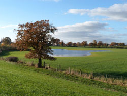
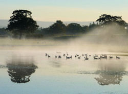
Poor drainage is a feature of Woodford, resulting in many permanent ponds and large seasonal floods in farmland and private gardens. This is a mixed blessing. On the one hand, permanent and seasonal ponds are an important aesthetic feature of the landscape with high value for wildlife. The most notable in these two aspects is the seasonal pond to the southeast of Church Lane, which is home to a number of red listed bird species. On the other hand, poor drainage creates problems for access because sections of many of the footpaths across farmland and Church Lane are regularly flooded in wet weather. The high water table and propensity for flooding are also issues for any form of construction.
Housing takes the form of ribbon development of varying densities. The highest densities are to be found along the main Chester Road, Wilmslow Road and Woodford Road, which form the spine of the settlement, and Moor Lane and Bridle Road, which branch off them. Frequent gaps in the housing line provide views into the countryside behind. Comprising around 600 houses, the Neighbourhood Area provides a wide range of housing types, including large detached houses with four to seven bedrooms and large gardens, two and three bedroomed semi-detached houses, terraced houses and bungalows, and a small number of flats. Low density housing is to be found along the rural lanes, including Church lane, Blossoms Lane, Old Hall Lane and Kingstreet. The majority of dwellings in Woodford overlook farmland at the rear. There has been incremental growth and change in the form of limited infill, barn conversions, replacement dwellings and extensions. The turnover of houses via market sales (Zoopla website accessed 2017, www.zoopla.co.uk) in the Neighbourhood has averaged at twenty per year over the last ten years.
A potentially unique feature of Woodford is the recent arrival of a large housing development on the former Aerodrome site, adjacent to the Neighbourhood Area. Planning permission for 920 dwellings plus a 100-unit care facility and commercial premises was granted in 2015 and building work has commenced. This large development offers a different type of housing compared with the Neighbourhood Area, comprising modern executive houses in the range of three to five bedrooms with small gardens, in a “garden village” style setting. The site will also include 15% affordable housing. Therefore, the new development will increase both the number and type of housing in the immediate locality. The population in the parish of Woodford will triple as a result of this development.
The majority of commercial activity is focused along the spinal main roads and includes the Davenport Arms, Olivers Restaurant, the Deanwater Hotel, Budgens convenience store, Woodford Notcutts Garden Centre, which includes a café, and a small parade of shops. In addition, there are many small businesses and professionals working from offices at home.
Community and leisure facilities include the Woodford War Memorial Community Centre, Christ Church and the Church Hall, located on Chester Road; a scout hut, British Legion premises, and Woodford Cricket Club on Moor Lane; and Bramhall Cricket Club on Church Lane. Although there is no longer a village school, which was once a focus of community interaction, there remains a strong sense of community in Woodford, with social interaction arising as a result of the community leisure facilities and the Church. Local groups include the Woodford Community Council, Woodford Neighbourhood Forum, Woodford War Memorial Community Centre committee, Parish Church Council, Woodford Community Players, the Women’s Institute and many other social groups.
The rural setting of Woodford is one of the most important features to residents and it provides a rich natural environment. The Neighbourhood Area is particularly rich in mature native trees, species-rich native hedgerows and ponds, which provide good habitats and corridors for wildlife connecting to adjacent rural Cheshire and providing ecological links into the more urban setting of Stockport.
In 2011, members of the Woodford Community Centre Management Committee received a donation of 100 sapling native trees, which were planted at the community centre by a team of volunteers as contribution towards mitigation of carbon emissions and improving the aesthetic quality of the grounds. In 2018 these saplings have matured to form a copse.
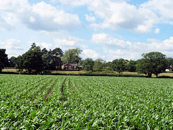
| Woodford Today |
|---|
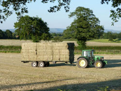 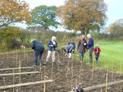 |
| Haymaking and Planting trees |
 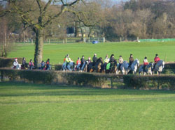 |
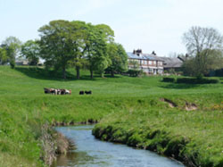
| Cattle rearing and Horse Riding |
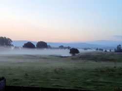
| Views |
 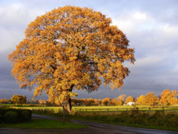 |
| Seasonal pond near Church Lane and The Barr Green Oak in Blossoms Lane |
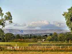  |
| View of Kinder Scout from Blossoms Lane and View of Pennines from Old Hall Lane |
Why is the ground wet? The Geology provides an explanation
Woodford is 5 kilometres west of a geological fault at Poynton, where the millstone grit of the Pennines dropped by 200 metres around 300 million years ago, during the Carboniferous Period. As a result, the aspect is open and flat with height in the range 90 – 95 metres above sea level. The land slopes gently down to the east, affording unobstructed views of the Pennines from many locations in Woodford, which are very much treasured by residents and visitors.
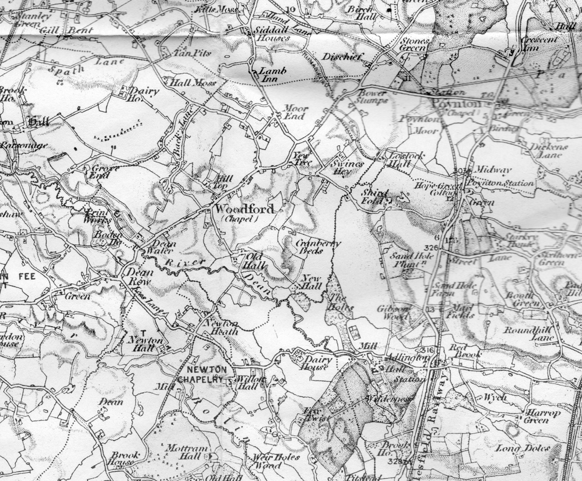
The first OS map of the village. Select image to view a larger version as a jpg in a new window.
Woodford lies on an aquifer consisting of ground water held in porous sandstones laid down 200 million years ago in the Triassic period, sand and marl (a crumbly mixture of clay and limestone). The aquifer is part of a series of deep basins throughout the UK, including the Cheshire Basin, which are important sources of ground water. This is an area of high environmental sensitivity because the sandstone is formally designated as a Principal Aquifer and there is a groundwater Source Protection Zone for a nearby public water supply abstraction. It is subject to Environment Agency groundwater protection position statements (available at https://www.gov.uk/government/publications/groundwater-protection-position-statements). The pumping station at the end of Church Lane taps into this water. The base of the Triassic sandstone layer varies from above sea level in outcrops at the surface, such as Alderley Edge, to deeper than 2,500 m below sea level in the centre of the Cheshire Basin.
The area was covered with glacial sediments as the glaciers of the last Ice Age retreated, forming the Cheshire Plain. The soils of Woodford consist mostly of clay, with pockets of sand, including running sand. Drainage is poor and in many areas the ground becomes water-logged and prone to flooding in wet weather.
Environmental studies conducted on the former Woodford Aerodrome site indicate that the site lies on an aquifer consisting of permeable, solid sandstone and pebble beds with high capacity for water storage. Above this, layers of sand and gravel hold some ground water, while extensive layers of clay are impermeable with very low capacity for water storage.
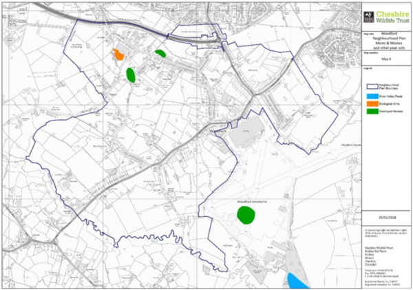
The Cheshire Wildlife Trust notes that Woodford falls within the Shropshire, Cheshire and Staffordshire Plain National Character Area, which is described as a pastoral area of rolling agricultural plain. At the end of the last ice age, this area was largely underwater. The water eventually drained away, but it left behind a wetland landscape of meres, mosses, rivers and ponds, which is of international importance for its wetland wildlife. Remnants of some of the mosses (meres that gradually filled up with peat and then were covered by vegetation) are still here today, located near Church Lane, Hall Moss Lane and on the former aerodrome site.
Map showing location of remnants of mosses (shaded green) in Woodford
(Reproduced with permission from the Cheshire Wildlife Trust).
| Listed Buildings |
|---|
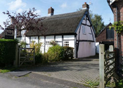 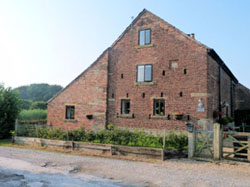 |
| The Lodge, Blossoms Lane and Old Hall Barn, Old Hall Lane |
|
| The Lychgate, Chester Road and Old Hall Farm, Old Hall Lane |